 01.04.2023


Konya Alaeddin Hill II. Kılıçarslan Mansion and Excavation Site Architectural Ideas Project Competition - 4th Honorable Mention
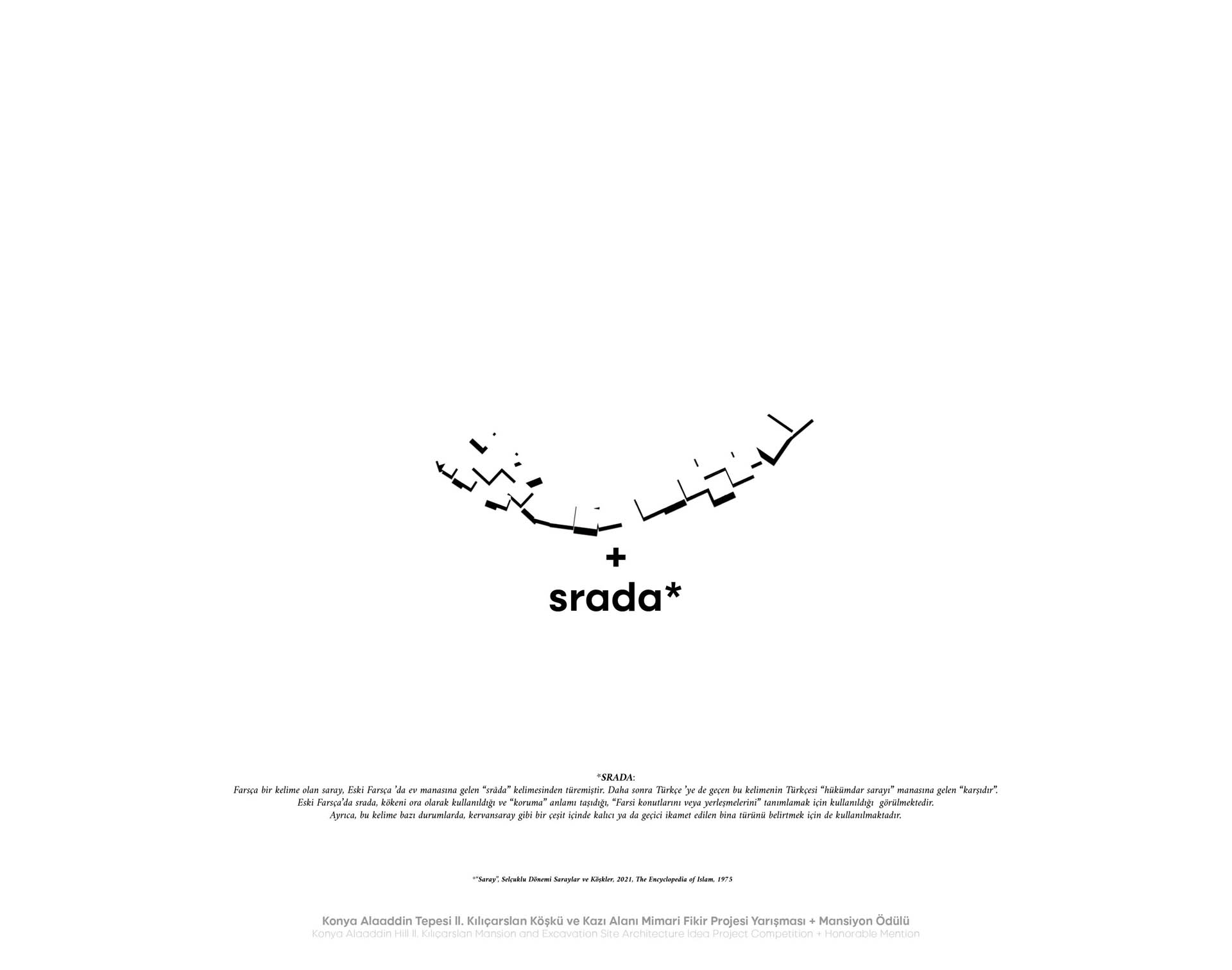
SRADA
The word "saray", which is a Persian word, is derived from the Old Persian word "srâda", meaning "house". Later, this word was also adopted into Turkish and its equivalent in Turkish means "royal palace". In Old Persian, "srada" was originally used to mean "protection" and was used to describe "Persian residences or settlements" (The Encyclopedia of Islam, 1975).
PROTECTION + SOCIAL INTEGRATION STRATEGY
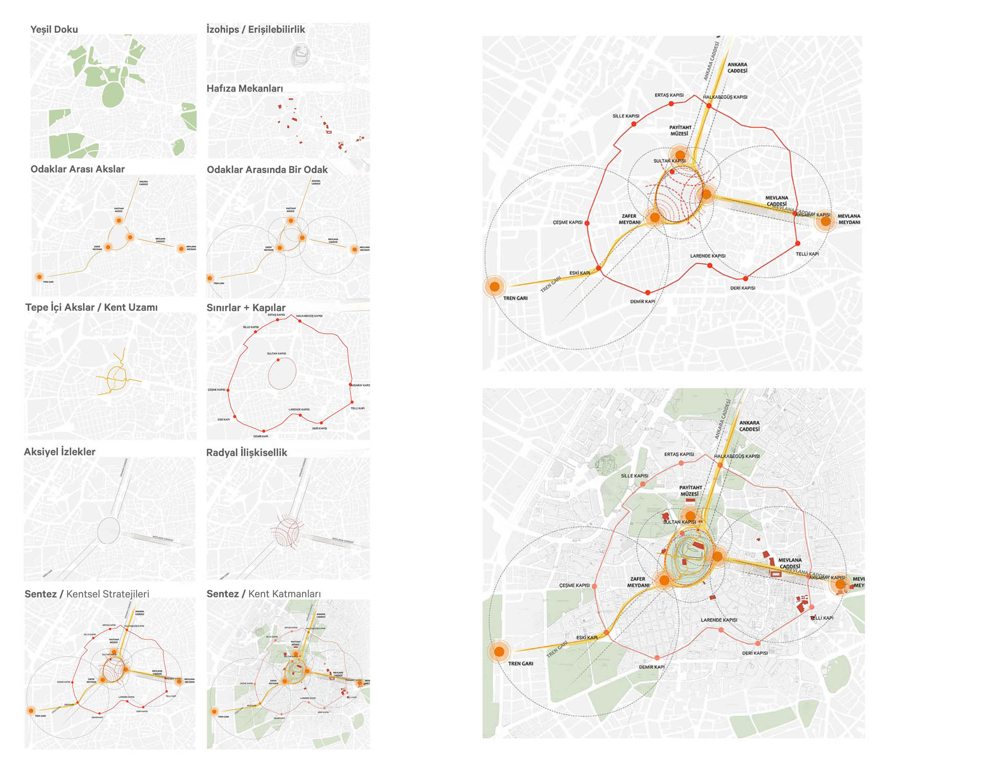
Konya is a city with a rich cultural heritage, which has developed on the cultural values accumulated throughout history and shaped the social structure of Anatolia, including the Anatolian Seljuk State. It is considered to have been inhabited since 7000 BC in the Konya region (Konya, 1982). In this context, it is one of the oldest settlements in Central Anatolia, and the first settlements that make up the city are dated to the Neolithic period. The first settlement that formed the city was also established in a place now known as Alaeddin Hill (Önder, 1971). Today, Alaeddin Hill is a tangible and intangible values center for Konya, as it has been a location of "state" presence and has been used for various functions throughout urban memory in every era. The current state of the palimpsest value accumulation is also gaining value due to the coexistence of different cultural layers. As Mahmut Akok pointed out, "On the mound, Seljuk, Ottoman, and Republican-era architectural structures can still be perceived today, and vanished architectural products can be shared based on archives. Within this complex structure, Alaeddin Hill constitutes the main nucleus of Konya city throughout all times" (Akok, 1968). The conservation approach developed according to the focus determined by the documents and field examinations aims to protect the values center that has become an "oasis" with its physical structure within the developing city in line with contemporary and universal conservation principles and at the same time to create a "meaningful hill" that can be felt within the daily life of the people and where social and cultural accumulation can be perceived, and knowledge about the history of the city can be gained.
In light of this data, the strategy developed can be described as a "Cultural Heritage-Based Social Integration and Inactive Urban Development Strategy". It is a design strategy that takes into account every cultural heritage layer in the area and aims to protect it, evaluates the urban potential and values in the area and its surroundings, and organizes the urban dynamics to enable experience within the daily life of the people, taking into account the physical structure of the hill.
Urban Interventions
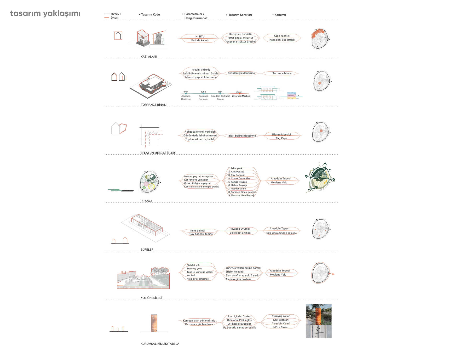
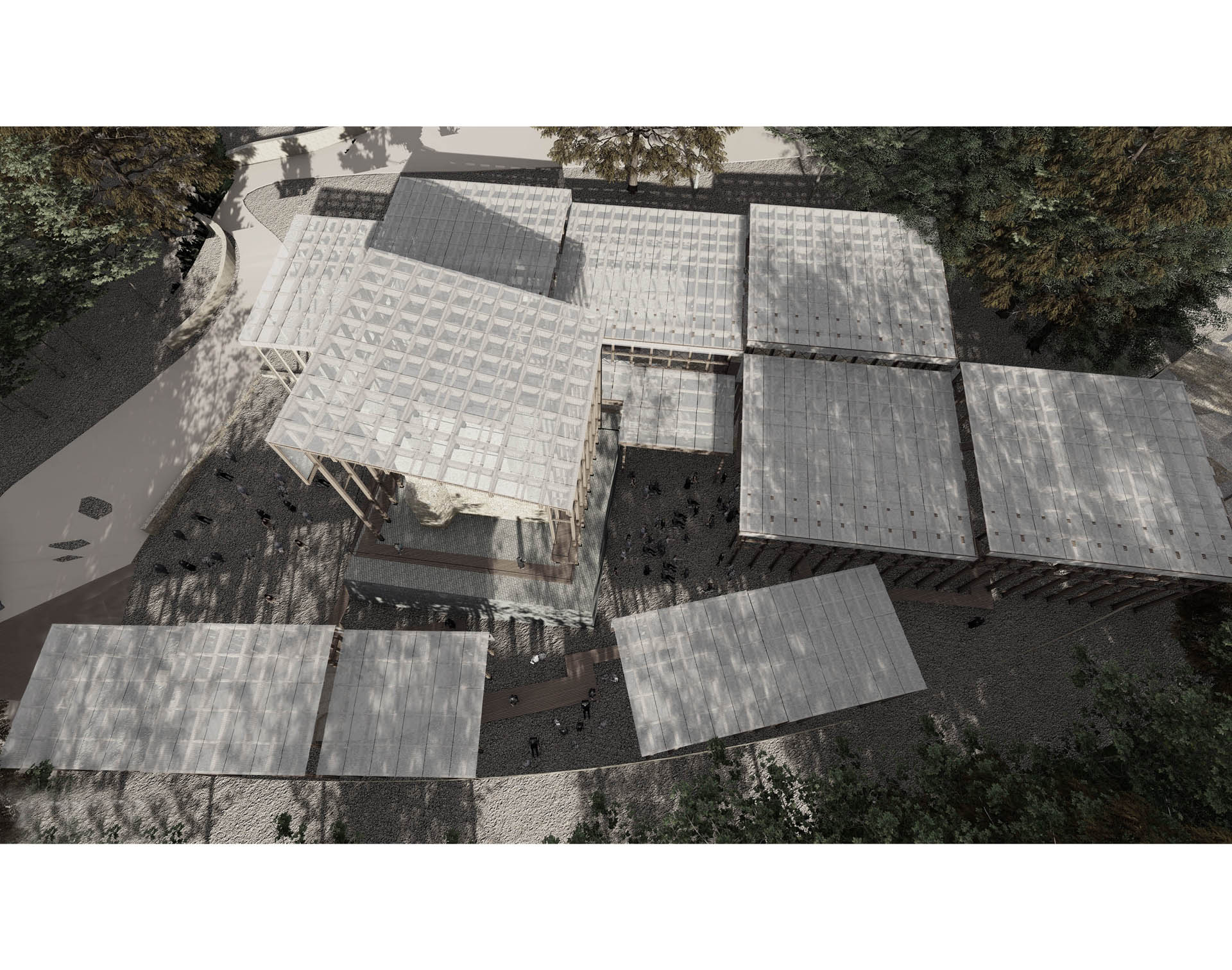
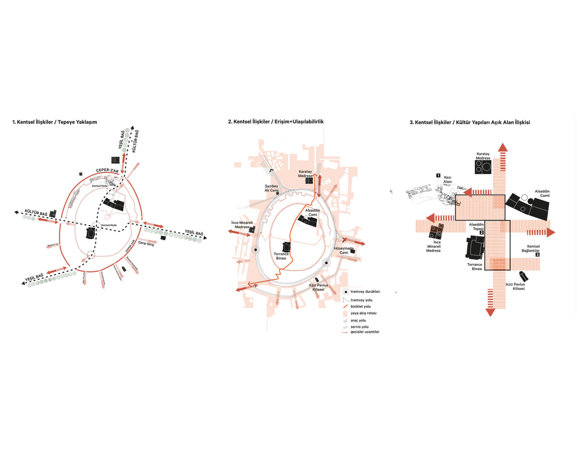
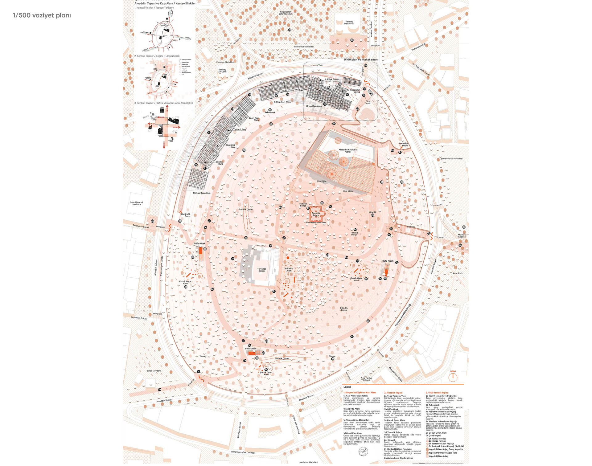
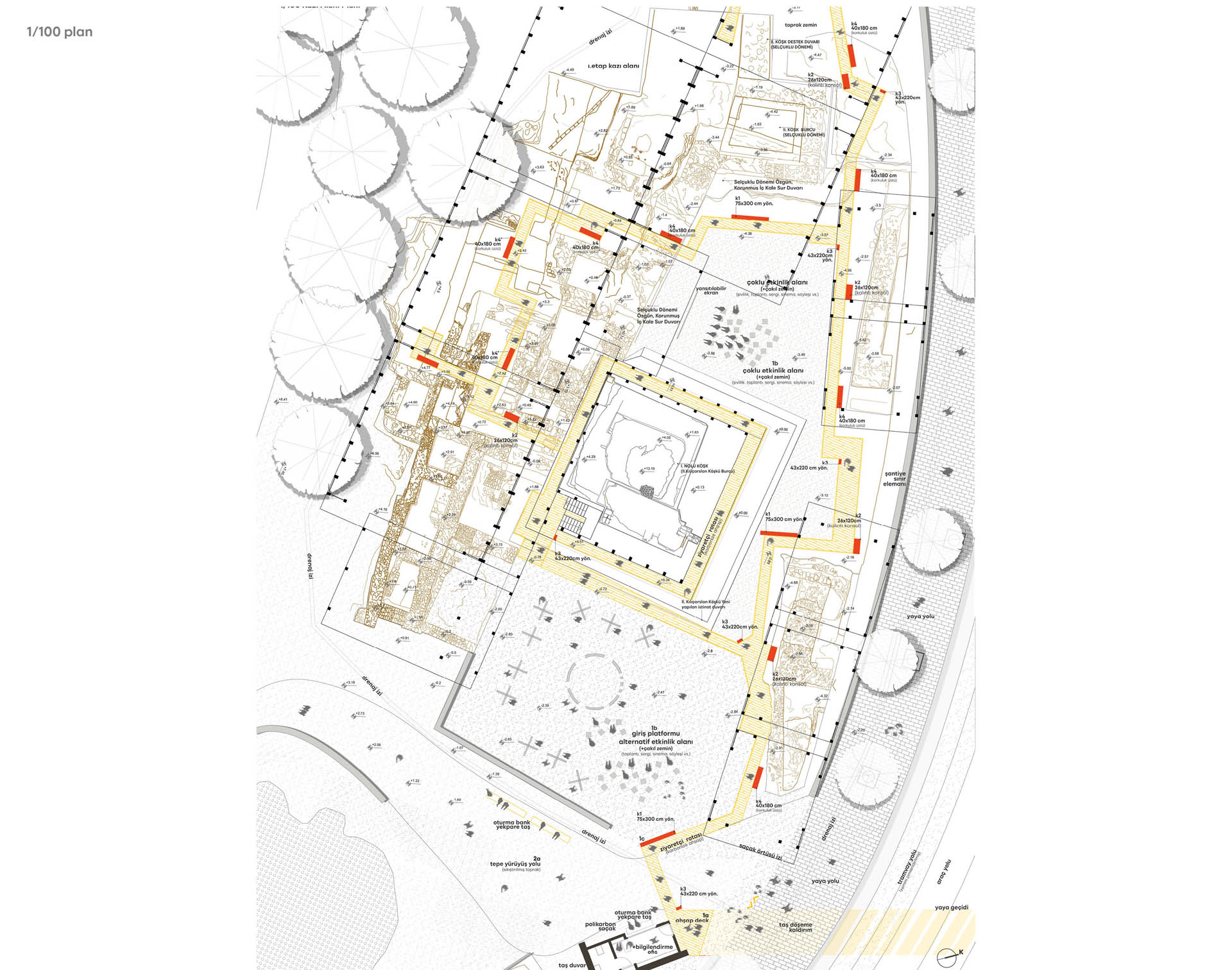
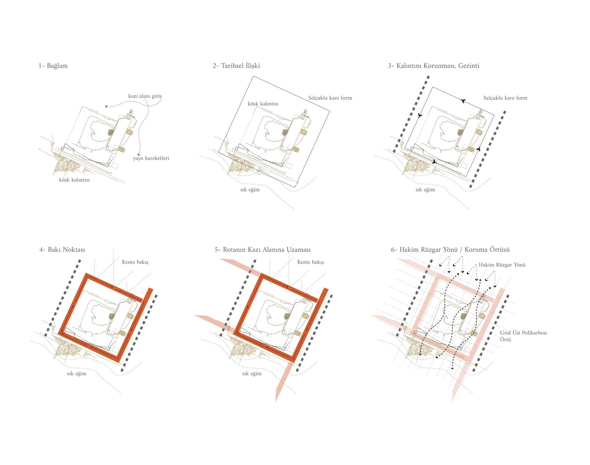
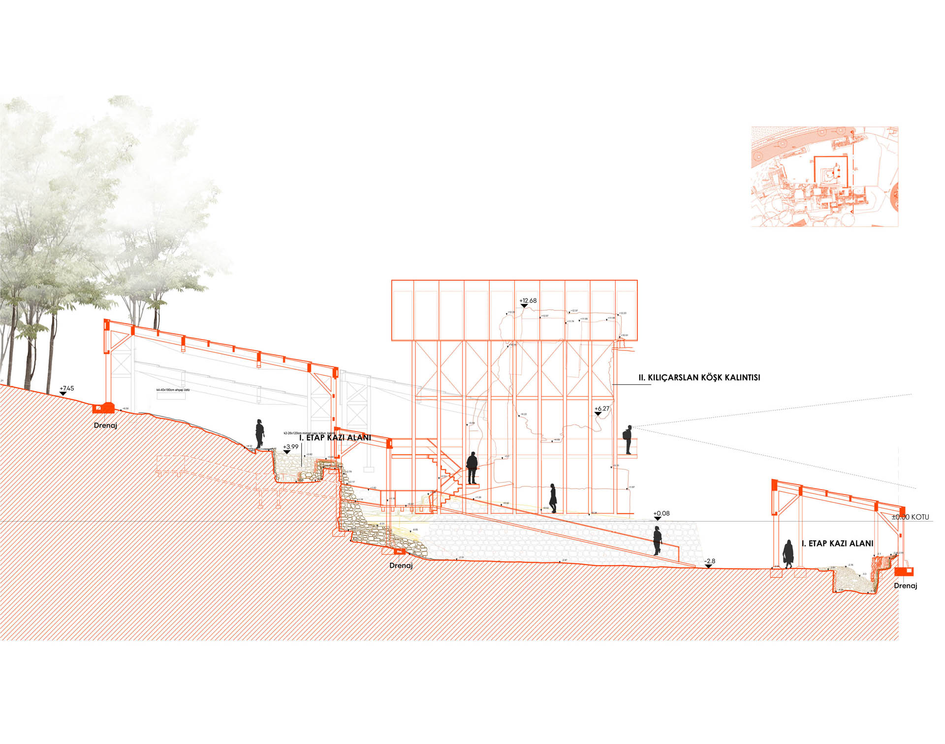
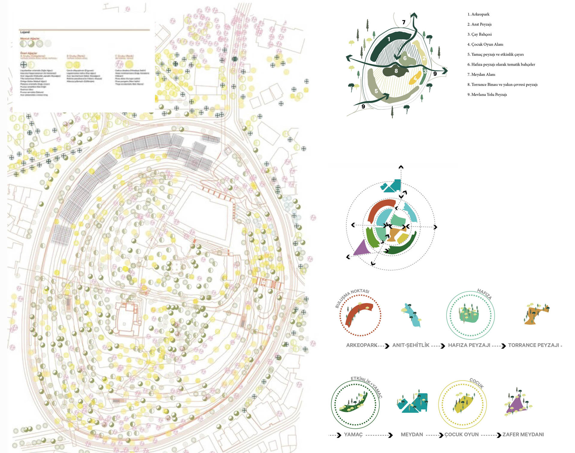
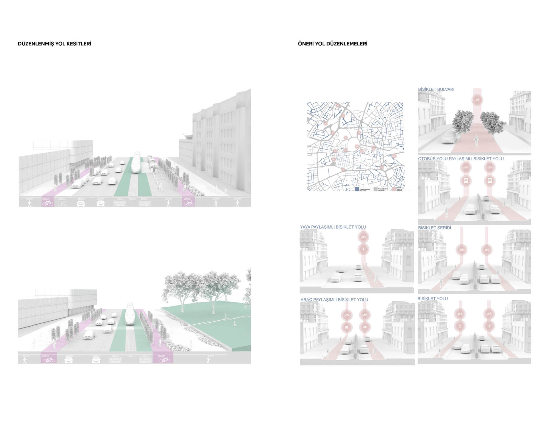
As a result of a design approach in which the principles of designing the functions that have been established in the urban memory were rearranged in accordance with the experience of the area as a pedestrian, and the road cross-sections of motor vehicle traffic were reduced, a synthesis was created where the area is located on 4 important urban flows, and 4 approach points were determined on the east-west axis that is decisive for the urban development of Konya.
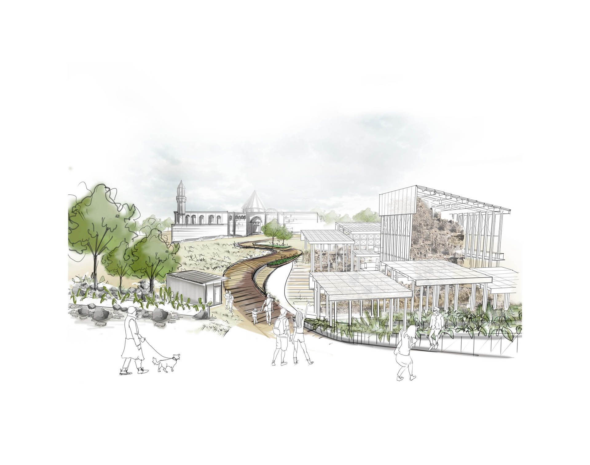
1- Martyrdom entrance: The strong urban connection established with the Mevlana Mausoleum was developed focused on the walking experience.
2- Karatay Madrasah entrance: The area designated as an urban focus along with the Palace Mansion structure was also designated as a visitor entrance for the excavation area. The area's pedestrian-oriented relationship with the Payitaht Museum was also established from this point.
3- Ince Minaret Madrasah entrance: It is the focal point on the west side of the area in the direction of the Mevlana Mausoleum-developed urban axis.
4- Park entrance newly arranged from Ankara Avenue/Zafer Square: It is another important pedestrian axis that connects the area to the train station via Atatürk Avenue.
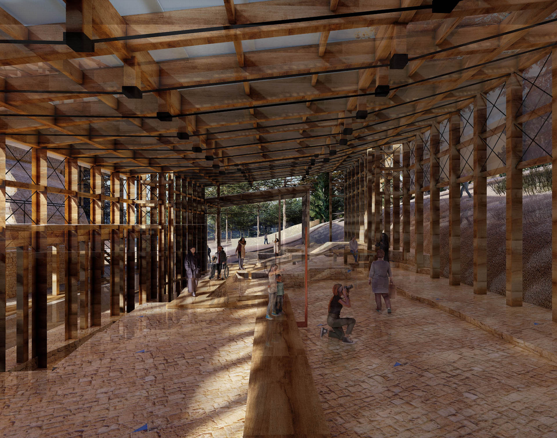
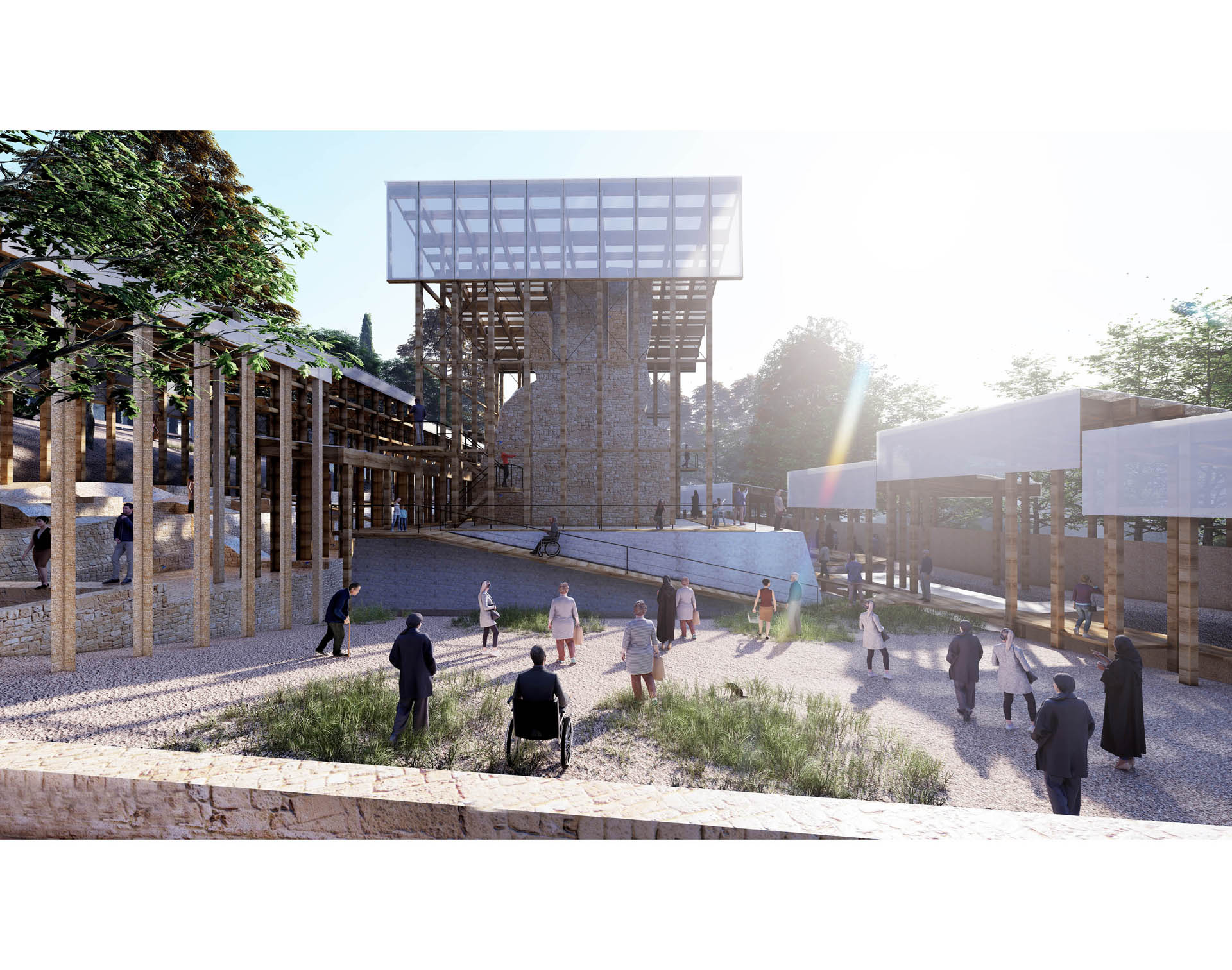
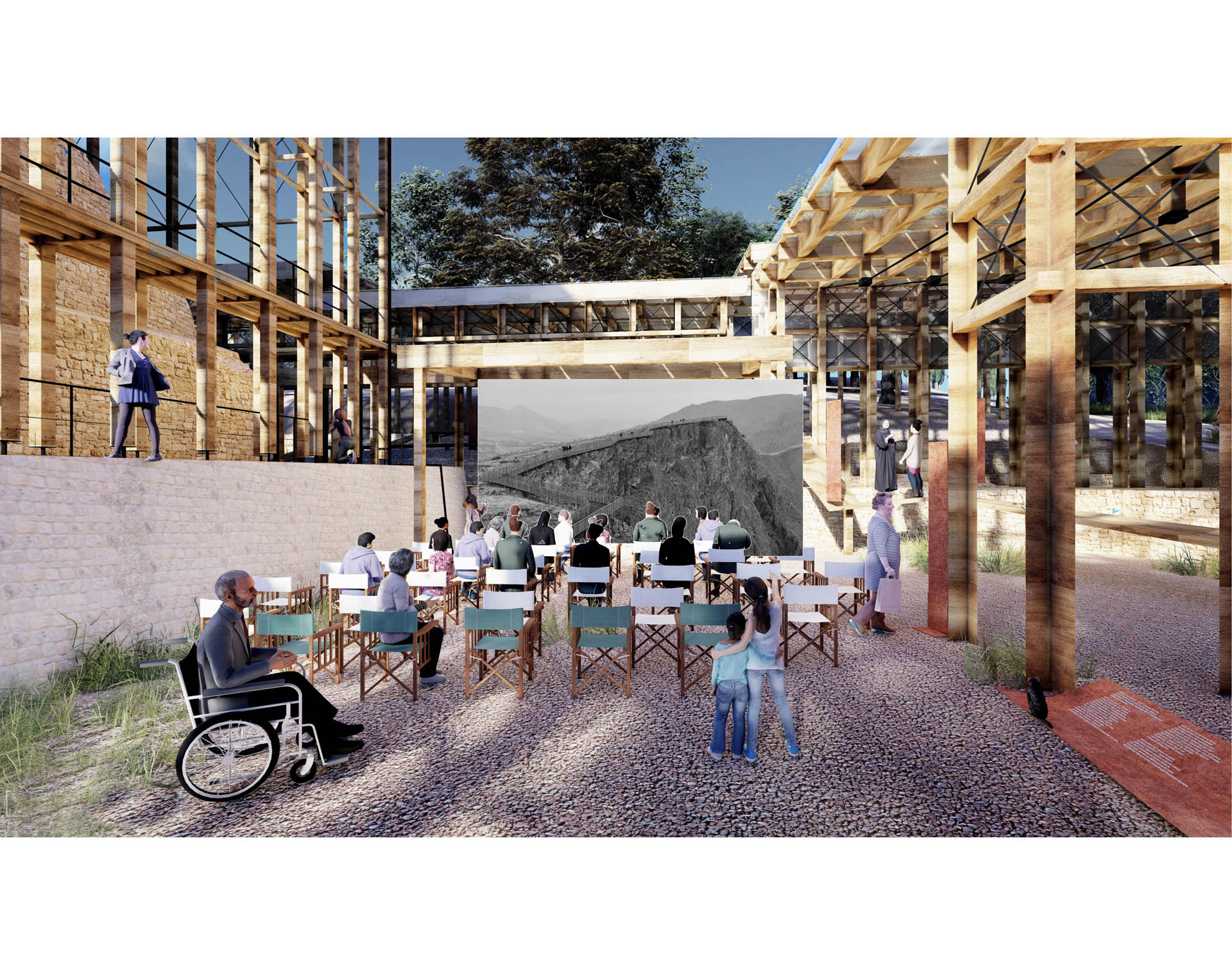
While arranging the pedestrian walkways within the area, it was aimed to be felt with the changing road form of connection and entrance points. All pedestrian walkways in the area were designed parallel to the slope and in accordance with inclusive design principles to ensure ease of access. Access to all proposed functions in the area is possible on flat ground. Since it was thought that there should be no vehicular traffic in the area, all new function proposals and transportation connections (except emergency transportation) were planned to be pedestrian-oriented. A bicycle route integrated with the existing bicycle paths was arranged. The existing tram line was preserved, and pedestrian connections were arranged according to the existing stations. The vehicle road surrounding the area was reduced from 3 lanes to 2 lanes, slowed down, and proposed to have reduced capacity of vehicular traffic. The boulevard landscape arrangement of the Mevlana Mausoleum axis was designed as a pedestrian-oriented, 1.5m landscape arrangement as a safety strip around the tram line, with a soft ground added with a 5m pedestrian walkway passing through it, and a wide sidewalk on both sides of the road to increase the use of ground floor functions. For the pedestrian walkways that need to have a hard ground inside the area, natural compressed soil was proposed as the ground material, and the pedestrian walkway cross-section was proposed to be a maximum of 4m wide, and the trail paths were proposed to be 2m wide. The intersection points of pedestrian walkways were personalized with square-shaped areas in accordance with the design concept. It was proposed to arrange the pedestrian crossings on the vehicle roads surrounding the area to slow down the vehicles, making them wider and raised to the level of the pedestrian sidewalk. In the green areas inside the area, thematic gardens aimed at providing continuity in the urban memory in line with the soul and physical character of the area were proposed.
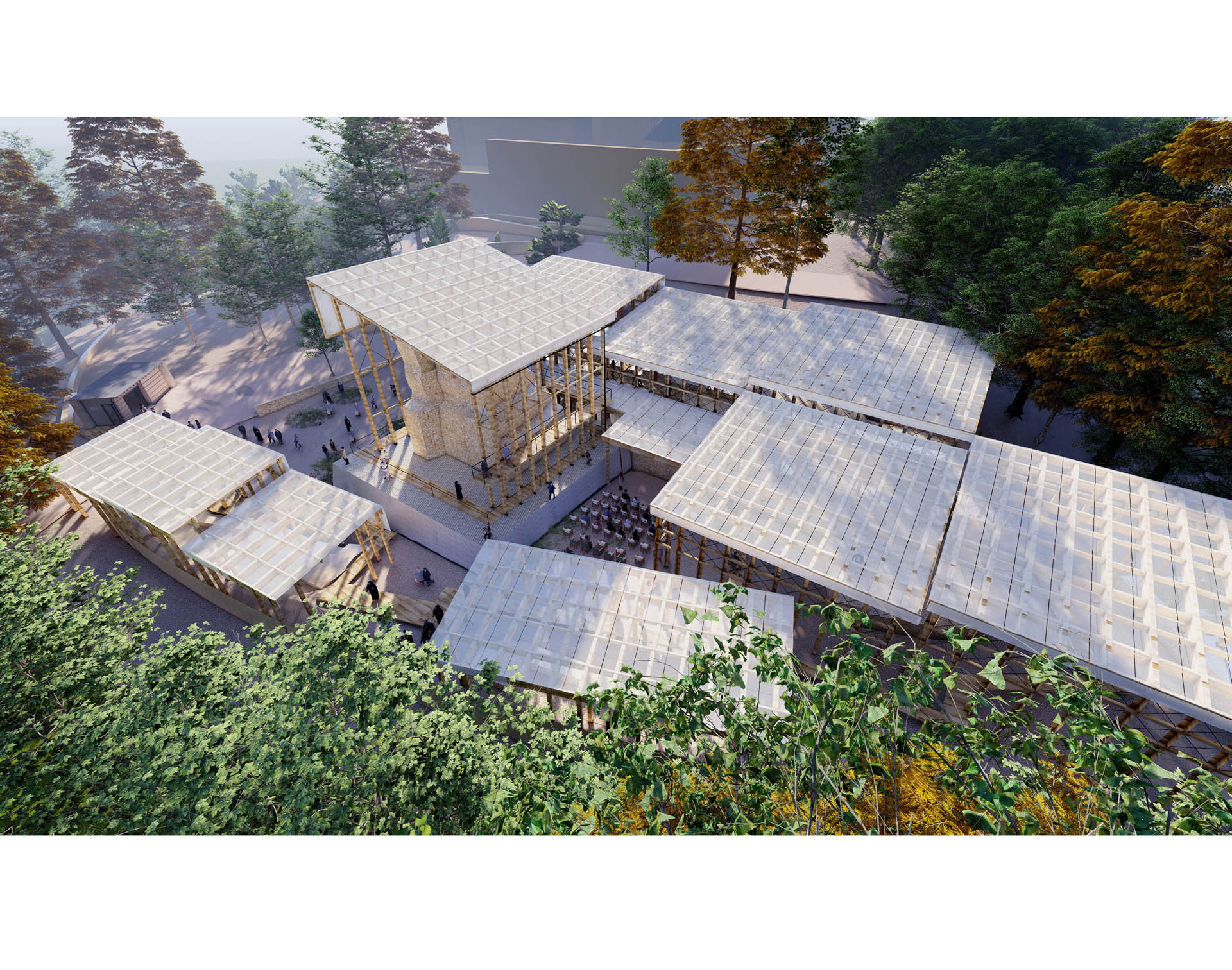
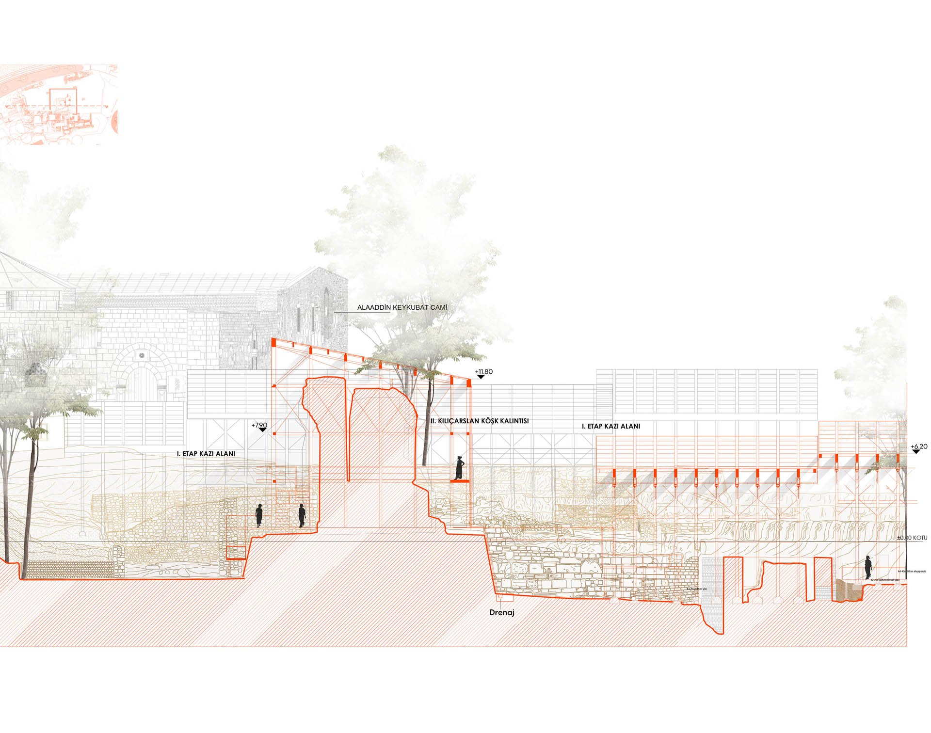
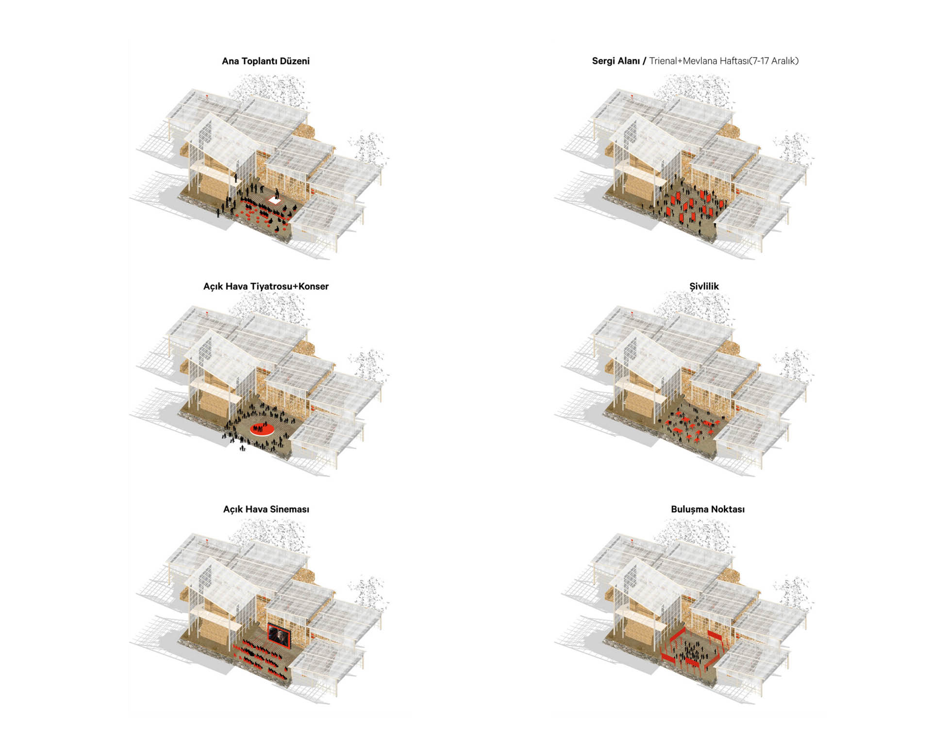
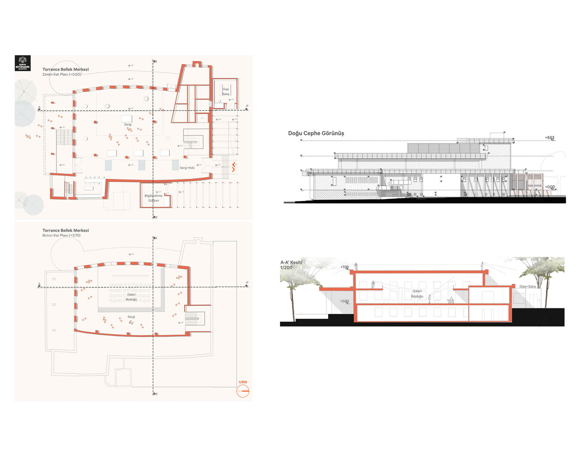
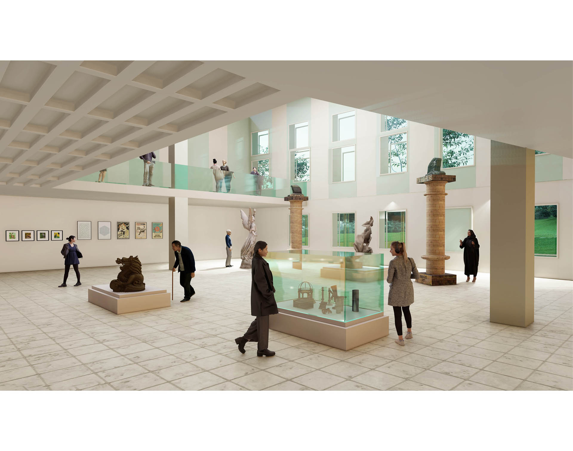
The current entrance of the Alaeddin Mosque is provided through a side door opened in the 19th century. The Sultan entrance on the north facade of the mosque has been transformed into the main entrance by creating a platform for the suggested pedestrian connections within the area. The Sultan Entrance platform, located in the northwest corner of the mosque, has been designated as the focal point of pedestrian traffic. The Payitaht Museum is designed to showcase the cultural heritage inventory of Seljuk Civilization, and a pedestrian connection reinforced by Karatay Madrasa has been established to provide direct access to the area. The wide urban void in front of the Payitaht Museum's façade is suggested to be reorganized by increasing the green/natural ground as specified in the zoning plan. The toilets, surrounding buildings, and the area behind the Ferit Pasha Water Depot, which are under protected status, are proposed to be transformed and rearranged as a library with necessary services (toilets, tea house, etc.) as they are not in harmony with the soul and value of the area. Tea garden/kiosk units, which have a place in the city's memory, have been redesigned in three areas in harmony with the area design concept and landscaping, and will be located under +1030 level. The extensive grassland area that emerged after the Ordu Evi Building was demolished is considered to add a separate value to the area in its current form and is recommended to be used as an event field at the urban scale.
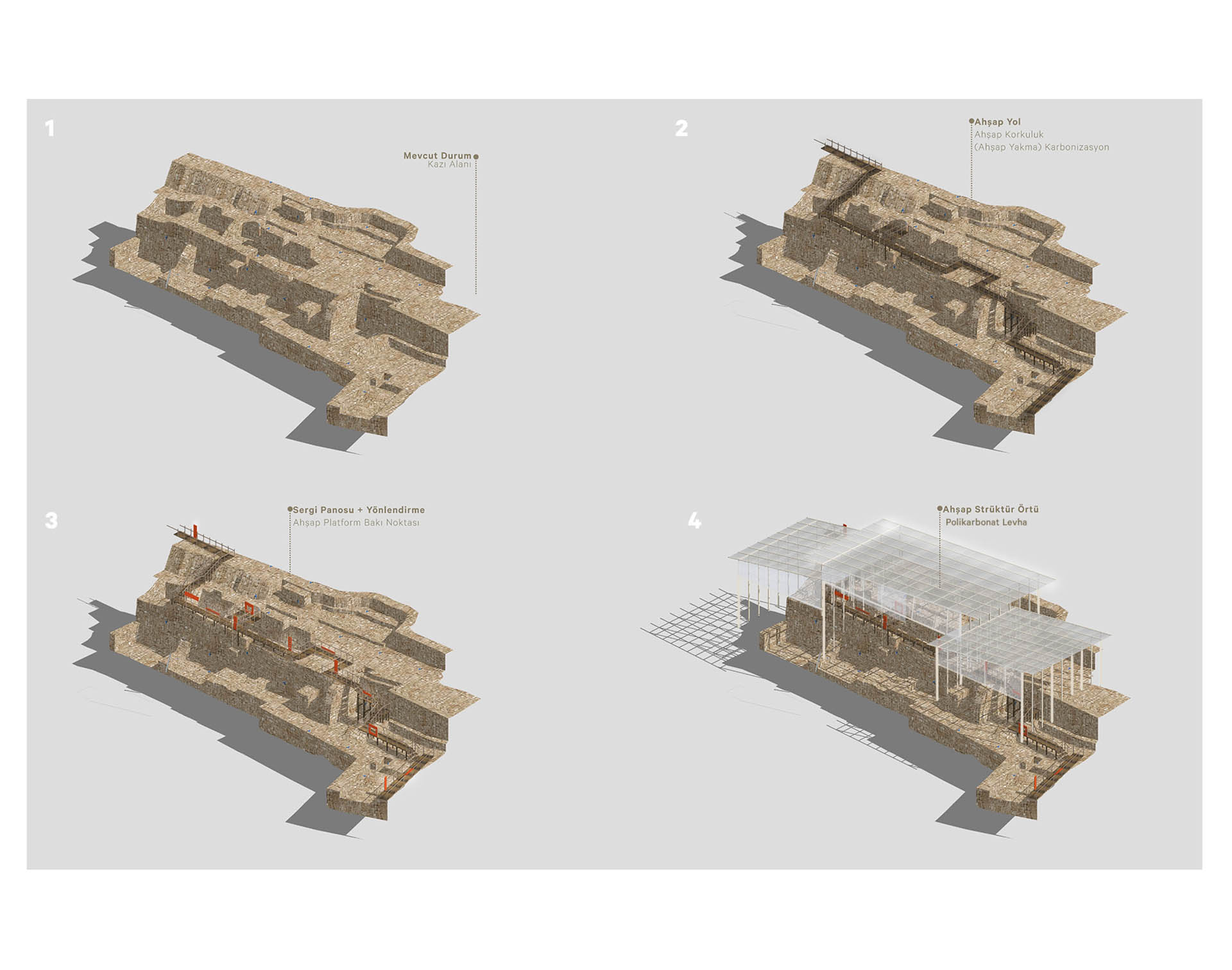
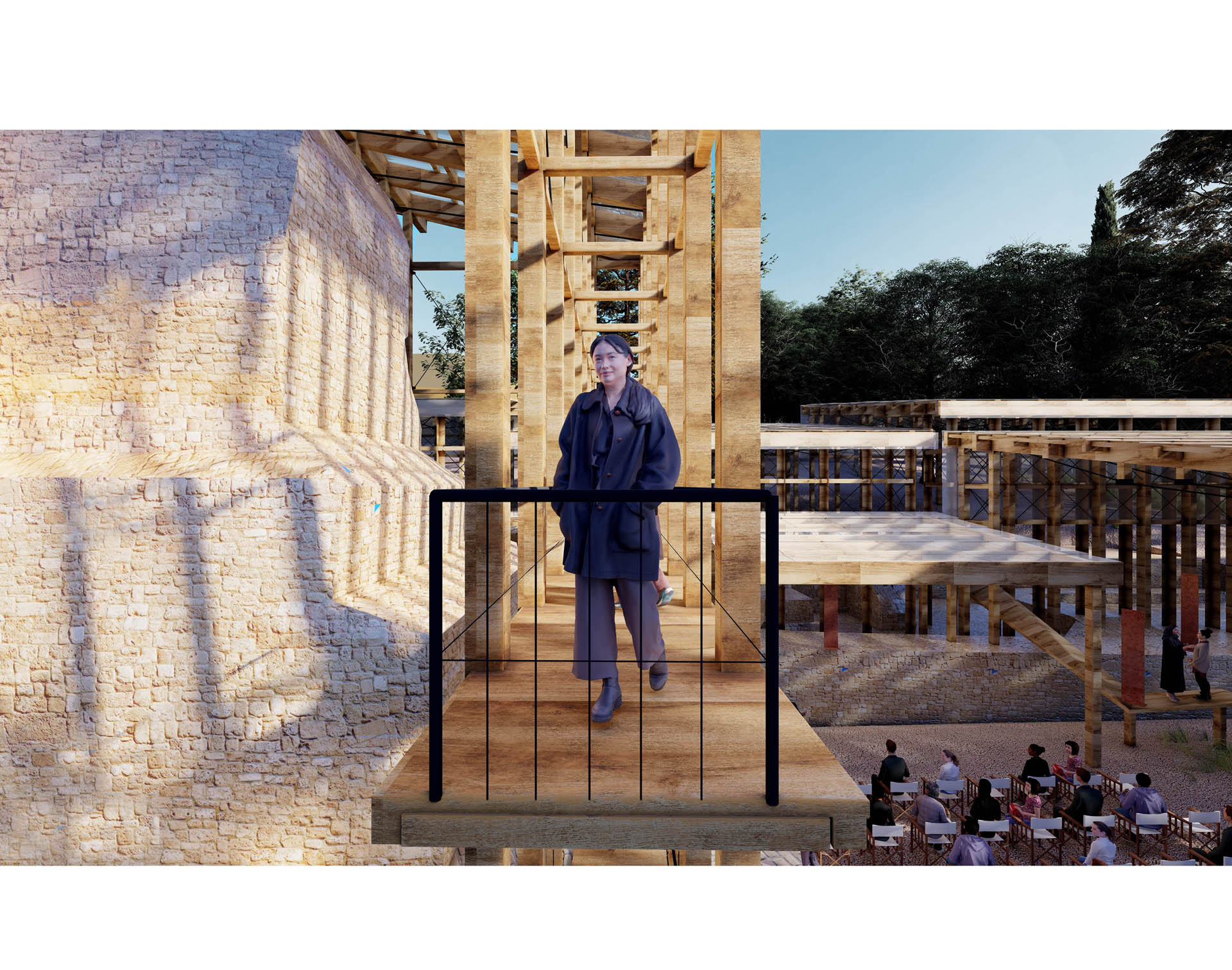
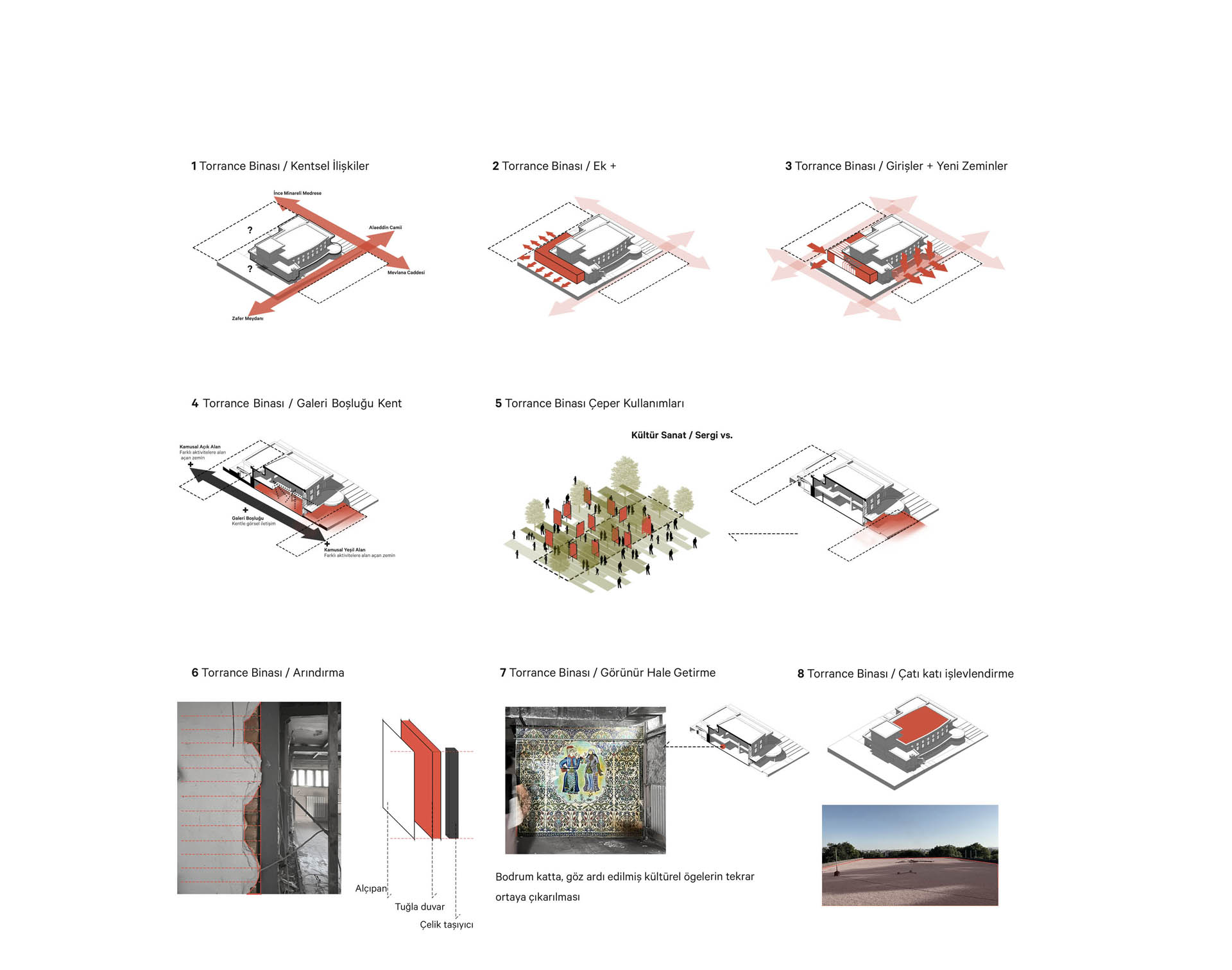
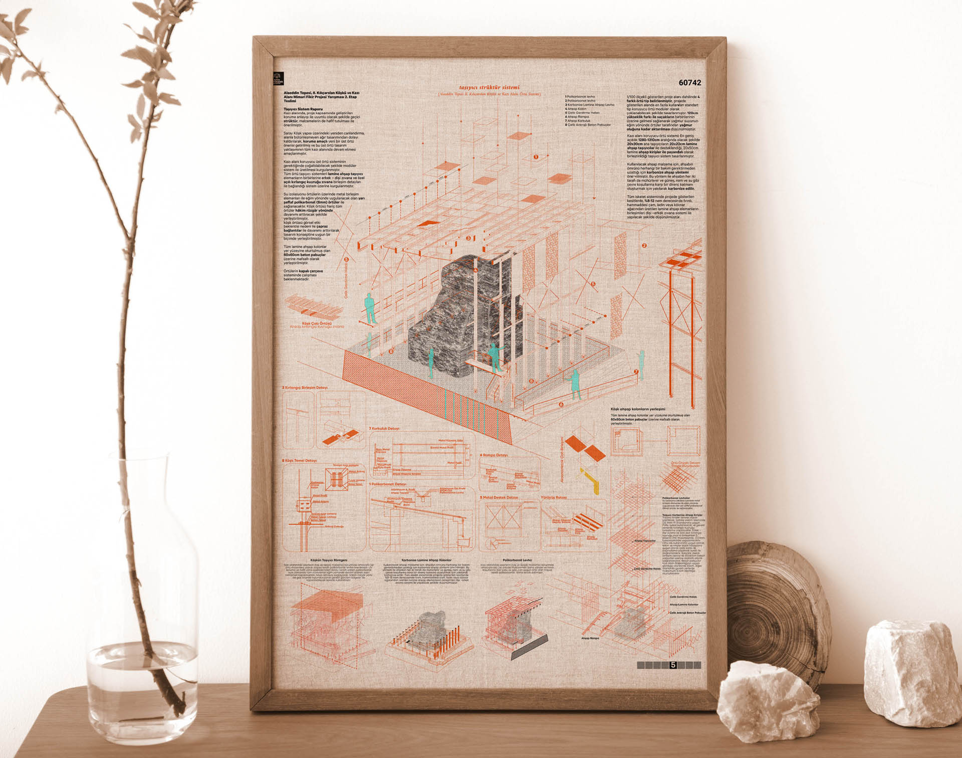
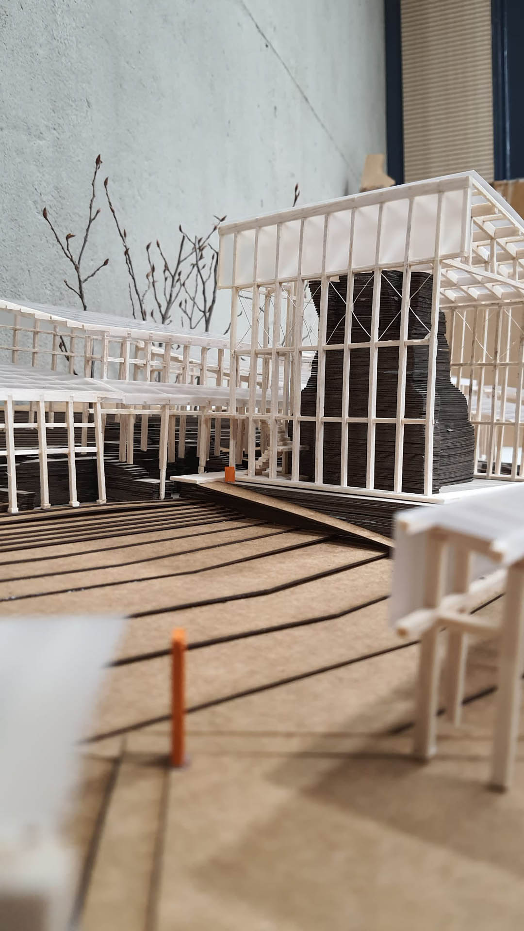
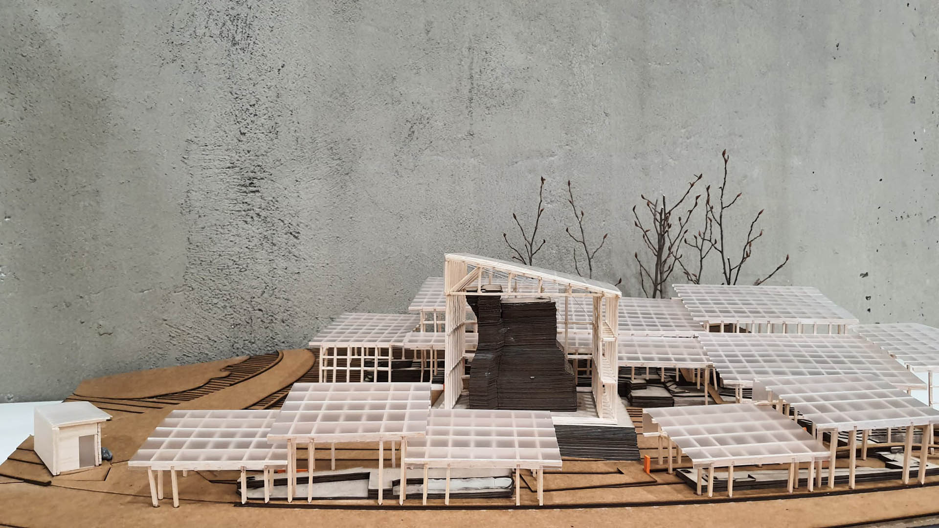
When the structures that have reached the present day in terms of both meaning and form of the historical layer that is the main determinant of Konya's cultural, social, and physical condition are considered, the structures of the Alaeddin Mosque and Kılıçarslan Mansion stand out. As stated in the work "Palaces and Mansions of the Seljuk Period," the Mansion structure "was built on an important mound in the middle of the city and was always in sight, attracting the attention of all travelers and researchers who came to the Seljuk capital, becoming a center of interest" (Konya Palace & II. Kılıç Arslan Mansion, 2021). The Mansion structure is an important focal point located in the perimeter within the area, which has become an "oasis" due to its greenery and cultural landscape value within the urban development. Since it is a cultural heritage structure that needs to be preserved due to its adobe structure, it has been used as a primary data for the design strategy. The current restoration work on the mansion is proposed to be removed as it is considered to be not suitable for the tangible and intangible values of the area and cultural heritage assets, according to Aydın and Yaldız's interpretation that the restoration work may damage cultural heritage (Aydın and Yaldız, 2022).

Related Content:
-

Sille Primary School
PROJECT, ARCHITECTURE 09.03.2024
-
SCADA | Kalyon Karapınar SPP Central Control Building
PROJECT, ARCHITECTURE 18.01.2024
-

The New School in Stara Boleslav Will be Built According to Chybik + Kristof’s Design
-
Development of a Master Plan for Grozny in the Chechen Republic
-
European Award for Architectural Heritage Intervention (AHI)
-
Kaira Looro Architecture Competition 2023


